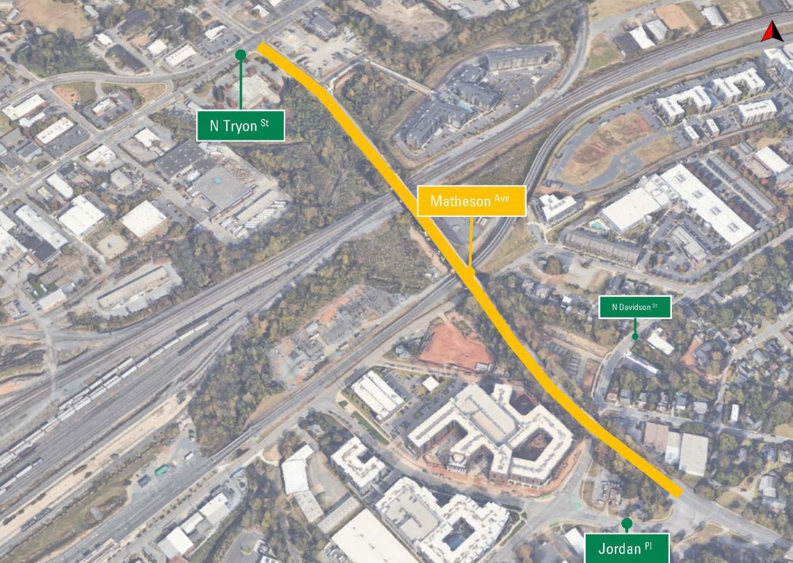
Matheson Avenue Bridge Streetscape
Temporary Closure
July 31, 2026 - Matheson Ave between Chick Godley Rd & Jordan Pl is closed in both directions to accommodate construction on this project. Ped/bike access will be maintained on the north side of the bridge for the duration of the closure. A signed detour directs motorists around the work zone using The Plaza, E. 36th St., N. Davidson and Jordan Pl. The roadway is expected to re-open in late 2026.
- Project typeEconomic Development
- Project budget$14.7 million (includes all costs associated with the project such as planning and design, acquiring the right of way, utility relocation, consultant fees, construction, signalization, permits and landscaping.)
- Project phaseConstruction
- Construction contractorBlythe Development Co.
Bridge Detour Map (July 27 - Dec. 31, 2026)

Signed detours are in place to guide motorists around the Matheson Avenue Bridge using North Tryon Street, East 36th Street, The Plaza, North Davidson Street and Jordan Place.
Part of the Applied Innovation Corridor
Project Overview
The Matheson Avenue Bridge streetscape project is the first of several projects scheduled in the North End Applied Innovation Corridor. This project will incorporate pedestrian, bicycle and aesthetic improvements on Matheson Avenue from North Tryon Street to Jordan Place, providing improved connections between North Tryon Street and the LYNX Blue Line, the Cross Charlotte Trail and the popular NoDa area.
This project will include a two-way cycle track along the south side and sidewalk along the south and north sides of Matheson Avenue. A three-foot-wide curb will be between the cycle track and the roadway.
The Matheson Avenue Street Conversion project, part of the city's bicycle program, is adjacent to this one and was completed in 2026. It provides streetscape improvements along Matheson Avenue between Jordan Place and The Plaza.
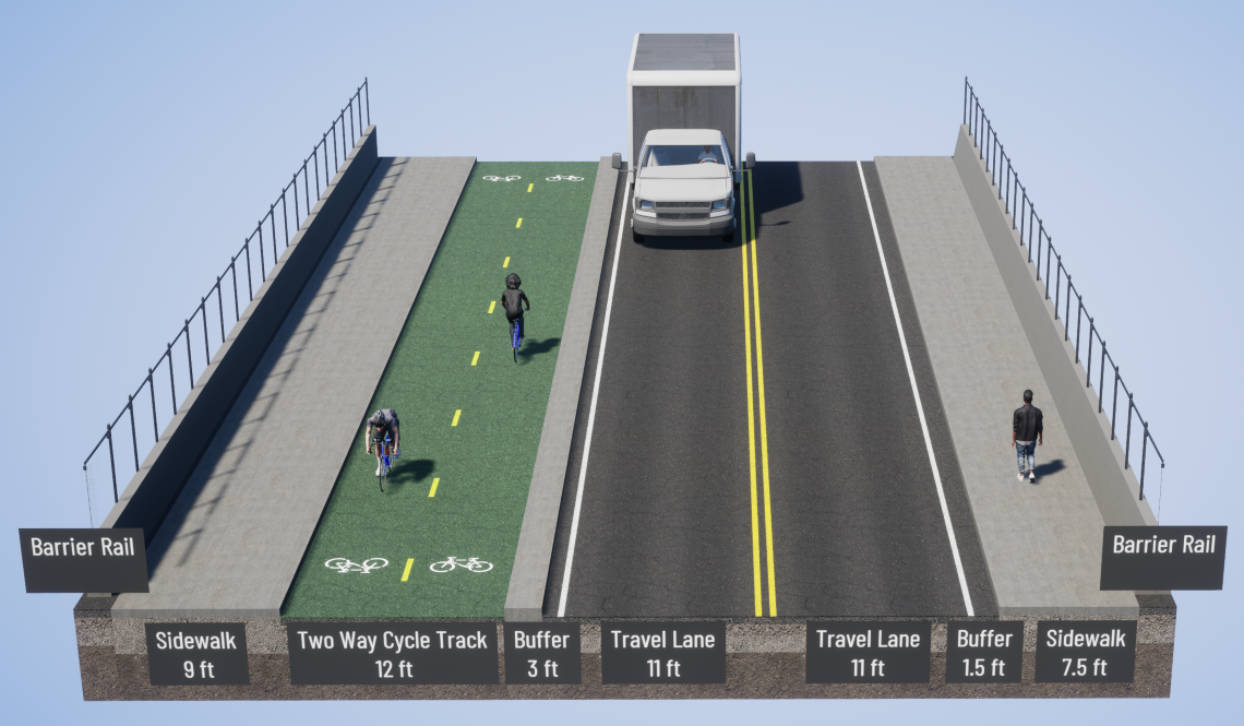
A rendering of a cross-section of the bridge after project completion. For illustrative purposes only.
Benefits identified from these potential improvements:
-
Provides connections to nearby LYNX Blue Line stations
-
Provides transportation choices for cycling and walking, specifically with this being only one of two facilities that cross the Norfolk Southern rail yard and LYNX Blue Line. The other roadway within the North End that crosses the rail yard is 16th Street.
-
Complements other public investments in the area, such as the LYNX Blue Line, the Cross Charlotte Trail (XCLT), North Tryon Business Corridor Improvements and the Northeast Corridor Infrastructure Program (NECI).
-
Provides potential leverage for public/private partnership - market analysis identified area in vicinity as strong potential for development
Project Goals
-
To provide safe travel connections for bicyclists, pedestrians and motorists over the railyard and into the surrounding communities
-
To provide aesthetic improvements for a more pleasing streetscape
Public Involvement
The City of Charlotte engages the community to gain input on the preliminary design that reflects the regions vision for infrastructure connectivity.
May 10, 2017: Joint public meeting with the Cross Charlotte Trail: Davidson to Matheson segment, at the Belmont Center.
May 11-June 12, 2017: Online meeting for this project and the Cross Charlotte Trail.
Vicinity Map