Prosperity Village CNIP
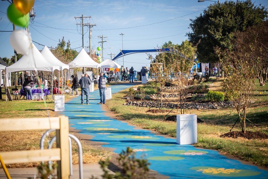
The Green at Prosperity Village
Why Was This Area Selected?
The Prosperity Village Comprehensive Neighborhood Improvement Project (CNIP) focused on the Prosperity Village area which is bounded by Eastfield Road and the Cabarrus County line to the north, Beard Road and Mallard Creek Road to the east, W.T. Harris Boulevard to the south, and Old Statesville Road to the west. The Prosperity Village area is a high-growth area of the City in need of increased connectivity to regional nodes and employment centers. The Prosperity Village CNIP was unique in that it was formed directly following the development and adoption of the Prosperity Hucks Area Plan (2015). The area plan focuses on the activity (village) center within the CNIP boundary. The Prosperity Hucks Area Plan was developed to provide a community-supported vision and provides detailed policy direction to shape the character and pattern of development.
CNIP looks to capitalize upon, and leverage upon, the assets of the area including:
-
A growing mix of land uses that provide an activity center with a choice of housing types, retail opportunities and community services.
-
Continued growth of single-family neighborhoods and nearby job centers.
-
A high degree of connectivity for vehicles, pedestrians, bicyclists and all users of greenways and open space.
Current Projects
 Craven Thomas Road/Robert Helms Road Streetscape (completed in 2023)
 DeArmon Road Complete Street Improvements (in progress)
Jimmy Oehler Road Sidewalk (completed in 2018)
Prosperity Church Road Improvements - Old Ridge Road to Benfield Road (in progress)
Prosperity Church Road Pedestrian Crossings (completed in 2020)
The Green at Prosperity Village (completed in 2020)