
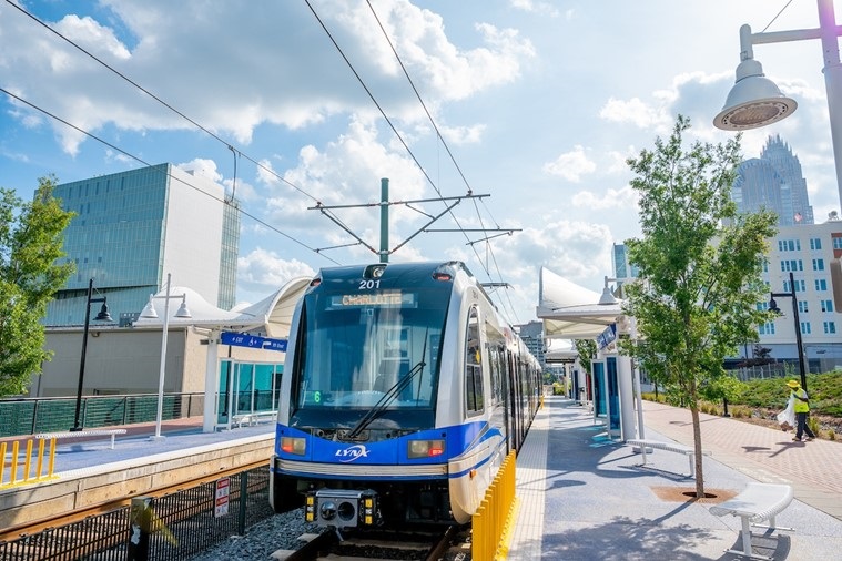
The Silver Line is a planned 29-mile, 30 station light rail alignment from the City of Belmont in Gaston County, through Center City Charlotte and the Town of Matthews in Mecklenburg County, and into Stallings and Indian Trail in Union County. Key connections include:
- Charlotte Douglas International Airport
- Bank of America Stadium
- Truist Field
- Charlotte Gateway District
- Gold Line Streetcar
- Blue Line Light Rail
- Bojangles Coliseum
- Ovens Auditorium
- Novant Uptown and Matthews hospitals
- Town of Matthews
- Sportsplex
- CPCC Central and Levine campuses
Over the last several years, CATS' policy board, the Metropolitan Transit Commission (MTC), has approved refinements to the Locally Preferred Alternative (LPA) and a phasing strategy for implementation of the Silver Line. Phase A extends eastward from Charlotte Gateway Station (CGS) to CPCC Levine in southeastern Mecklenburg County; Phase B extends westward from CGS to I-485 in western Mecklenburg County. Subsequent phases would extend farther in each direction into Gaston and Union counties.
In the near term, CATS anticipates taking the Phase A segment into design and environmental review. This first phase is considered the Silver Line Project. The proposed Project is an approximately 15-mile light rail transit alternative on new location from Center City Charlotte to the Town of Matthews. The western terminus would be at either the Charlotte Gateway Station (CGS) or Morehead station, and the eastern terminus would be at CPCC Levine. The Project would include 17-18 stations and a vehicle maintenance facility or combination of facilities.
Directions for viewing the map on a mobile device
Directions for viewing the map on a laptop or desktop
- To view the legend, click on the Details button in the top left of the screen and then select the far right Legend button.
- To change the basemap, click Basemap in the top left of the screen for options.
- To zoom in and out, use the “+” and “-“ icons at the top left of the map or use your center mouse button.
- To return to the original view, click the house icon at the top left of the map.
- To search for an address, type an address in the Find address or place search bar next to the magnifying glass icon on the top right of the screen.
-
To measure distances, click the Measure button in the top right of the screen. Select the ruler icon and use the drop-down list to select measurement units. Then click on the map to create a starting point, draw a line, and double click on the end point for your measurement result.
Related Efforts
- Silver Line Project: Visit the Silver Line Project page to learn more about the current light rail project status and next steps.
- Transit Oriented Development: Charlotte Planning, Design + Development partnered with CATS and other municipalities along the Silver Line LPA to develop station area plans which prioritize connected neighborhoods with a mix of uses that are consistent with local goals and policies. Visit the Transit Oriented Development (TOD) Study page to learn more.
Public Engagement
CATS has conducted extensive public engagement, including several online open houses, live virtual public meetings, neighborhood meetings, and surveys. View previous project materials and watch meeting recordings on the Silver Line Project Library.
Silver Line Project Library
The Silver Line TOD Study was completed in March 2022 by the Charlotte Area Transit System (CATS) and the City of Charlotte Planning, Design & Development Department. The study provides guidance for future development in areas around proposed Silver Line light rail stations. The study team worked with a broad coalition of residents and partners to develop a vision for the corridor. (The TOD Study was a separate, complementary effort to the ongoing engineering design of the Silver Line.)
Through the Lynx Silver TOD Study, CATS and the City developed two primary reports to guide future development within the proposed Silver Line station areas.
Silver Line Transit-Oriented Development Study Final Report
This report outlined specific recommendations for transit-oriented development (TOD) around each of the 31 proposed Silver Line stations. The content and recommendations are tailored to the unique context and public input received for each specific station area. Download the Silver Line TOD Report below:
Silver Line TOD Final Report(PDF, 105MB)
CATS Station Area Typologies Manual
This report outlined the planning, urban design, and development of future transit stations. It is designed to complement the station site selection process and inform station area design considerations. Download the Silver Line Station Typology manual below:
Silver Line Station Typology Manual(PDF, 2MB)
TOD Principles
- Enhance Connectivity: Connect other travel modes – walking, biking and driving – to the light rail to create an expansive transportation network.
- Encourage a Mix of Land Uses: Focus a mix of complementary, well-integrated land uses within walking distance of a transit station.
- Enhance Community Identify: Design attractive and safe stations to enhance community identity and promote walking.
- Expand Job and Housing Opportunities: Optimize transit to enhance economic mobility and access to jobs; increase affordable housing and neighborhood amenities.
Station Area Typologies
Different station types are described below. Each station area typology was determined by a variety of factors, including how transit customers access the station, land use context and the Charlotte Future 2040 Place Types, urban design / placemaking considerations, and market factors.
Walk-Up
Walk-up stations are intended for dense, highly-walkable built environments. This station typology is most appropriate in locations with existing or planned/funded moderate-to-intense land uses. Walk-up stations are primarily accessed by walking and bicycling and have no on-site vehicular parking. Bus connections and rideshare drop-off may have designated on-street space.
What Station Areas are Walk-Up?
- Berryhill
- Summit Ave
- Graham Street
- First Ward
- Central Ave
- Pecan
- Morningside
- Village Lake
- Downtown Matthews
- Sportsplex
Ride-Up
Ride-up stations are intended for areas that still have a walkable and bikeable built environment in contexts where drop off is anticipated for successful ridership. These stations are accessed by walking and bicycling and have accommodations for ride-ups and drop-offs and shared mobility. Ride-up stations typically have limited personal vehicular parking, but parking may be provided depending on site conditions and context. Bus connections for this station area can occur onstreet, and the station may include limited layover spaces.
What Station Areas are Ride-Up?
- Sam Wilson
- Boyer
- Morris Field
- Ashely
- Remount
- McAlpine
- Galleria
- Matthews Township Parkway
- Indian Trail
Commuter
 Commuter stations are intended to serve the largest populations and are typically found near and accessible to key arterials and interstates. Often, these stations are located at or near the end of rail lines. These stations include significant parking facilities for personal vehicles, along with accommodations for all other modes. The parking facilities may be surface lots or parking structures and can include bus connection/staging areas.
What Station Areas are Commuter?
- Belmont
- I-485
- Sharon Amity
- Conference Dr
- CPCC Levine
- Stallings
Destination / Transfer
Destination/transfer stations can be functionally identical to walk-up, ride-up, or commuter stations with the notable addition of connections to other premium transit, mobility hubs, or a major destination at the stop. These stations are intended to accommodate large crowds as well as connections to multiple other modes including streetcar, multiple bus routes, and more.
What Station Areas are Destination/Transfer?
- Airport
- Morehead
- Gateway
- 11th St
- Bojangles Coliseum